Saturday, October 10, 2015

PRETTY ISN'T IT?


...Being a lengthy, convoluted and arcane account of the creation of this art. Not recommended for anyone actually seeking useful information...


I Guess it all started with a quick Google search. We had dawdled away lots of prime autumn weather with doctors, Volleyball and football. There were just a few days to reach Jonesborough TN and the International Storytelling Festival.. Al Thought he remembered the Distance at 630+ MILES and projected a two day excursion by (Aghh!) Interstates--Montgomery, Birmingham, Chattanooga, Knoxville, local transition to Jonesborough..

When Patty slipped into the Navigator's seat and adjusted her Black Belt in Ipad navigation, Al was already whining about the route he had chosen.

"I wish we didn't have to go through BIRMINGHAM..."

IN A VERY SHORT TIME, he received the revised clearance.

"Airsteam 26, in 22 miles, right turn on State Route 145. Transition to county 61, report Wilsonville"

(I love it when she talks Air Traffic Control.)

"Oh, and Honey, that's six and a half HOURS and we are now looking at an ETA of 7:15. We could make it in before dark and no overnight at Walmart ."

The road was gorgeous two lane with no traffic. We slipped around Birmingham , enjoyed the renovated interstate along Lookout Mountain and generally had a smooth flight, err, drive.

We were approaching Jonesborough as the sun was setting; we were low on fuel but the onboard calculator said we had enough...(If we stopped for fuel, we would lose 15 minutes we would need to slip into our preselected site before dark.) We proceeded on...

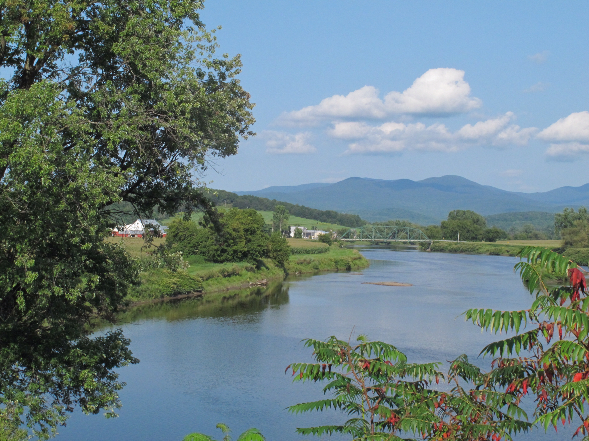
The transition from I-81 to the Persimmon Ridge campground was typical Middle Tennessee two lane --short steep hills, sweeping curves, double 90 degree turns . It was the golden hour and the barns and pastures glowed. I would be lying if I told you I didn't LOVE pulling an Airstream through those roads! We entered the campground in plenty of time to slip into our accustomed site.

The Fuel Monitors (both of them) were not happy, ringing bells insistently and inquiring in plaintive tones if we wanted her to search for a gas station...

Wait! An old white van was parked askew in OUR space -- No hookups, no camping gear in sight. One of our Texan friends who always arrive here a few days before us appeared at our side and, because this is the storytelling festival, gave us the long version. The key points being, apparently homeless older woman, quite skittish and hardly approachable.

"We have been bringing her food and offering help and kindness, but she seems confused. I THINK the manager told her you would be in tomorrow"

'nuff said. We will find another spot. You should know that this little city campground, while handy, is hardly uniform in its offerings. Few sites are level, some have workable connections and most have at least one oddity. The whole place is on a steep hill, each site being its own narrow little terrace. It was now Pitch Black Dark. We chose a site which had no less than six water spigots within reach, a sewer pipe and a brand new 30/50 Amp electrical box in a trench of newly turned red clay. The jaunt up the hill and back down set the fuel monitor into apoplexy.


Did I mention that it was Pitch Black Dark? Not to worry, we had Technology in the form of two little orange LED hazard beacons which could be aligned to provide a visual glide-path. So, with his lovely little Air Traffic/Ground Controller on the walkie talkies and our sweet Texan friend assisting, Al began backing into a terraced site with a mud hole below the upslope platform on the right and a three foot drop of exposed red clay on the left. It was a field of red clay relieved only by mounds of gravel. Yes it was still dark, but things were going along well. Al couldn't SEE the condition of the surface, but he could see the orange flashing beacons UNTIL Pat's instructions didn't seem to jibe with reality. He stopped. One of the beacons was MOVING! It wasn't an alien abduction; Tex felt Al might run over the beacon and was now holding it four feet off the ground approaching the driver's door to explain

We abandoned the attempt when Patty got a pyramid of leveling blocks FIVE high and we weren't level yet. We stationed Tex in front to watch our clearance from the only other rig in the row and Ground Control vectored Al into the next site below the three foot clay slope (remember that, there will be a quiz). This time five blocks high got us level. We locked everything down, lay our cheap Costco carpet over the red clay and Al limped off to the nearest fuel stop.

In the morning we deployed the awning as rain was imminent. Later we watched our new neighbor position his long trailer a little crosswise in the site we abandoned. Jim parked his Tow Vehicle beside his trailer on the brink of the red clay terrace. We greeted and exchanged cards and a little travel history and headed out for the day's adventures in a light rain.

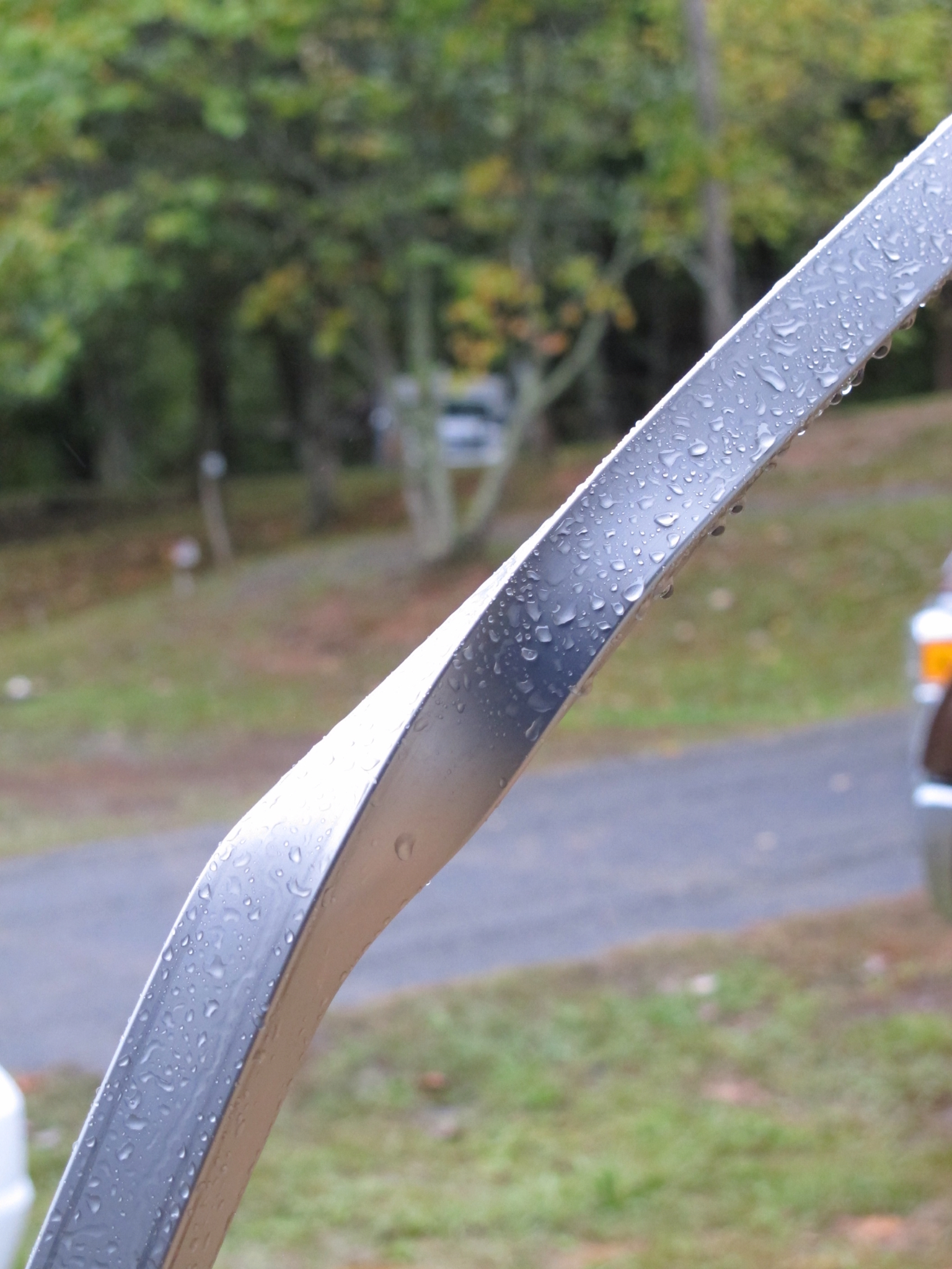
Midday Jim calls. The pickup had spun out on the clay slope and slid into the upright to the awning. His truck had a dent, our trailer was still poised on its pyramid, but the upright was crushed and the Sculpture above was created from the cross beam. Jim was sick and apologetic but a man of action. He assured us all would be made right, he already had an RV tech on site and the long process of finding parts for a Dometic awning (that Airstream only used for a couple years) was in full swing coast to coast -- a totally satisfactory outcome and a new friend. Oh Yes, there is ART. Any pointers on how to site the work?

FURTHER PHOTOS FROM THE SCENE OF THE CARNAGE:


Monday, August 31, 2015

ACADIA NATIONAL PARK....Some things change...

...but very little.


There's the sea, the fragrant greenery and the immutable stones...and, of course, the boats...


Nearly every year since their honeymoon, Joanie and Tim return to Acadia. We often tag along.


This year we scheduled two weeks at Seawall Campground in the Park while they rented Aunt Betty's Cottage near the heart of Bar Harbor. They enjoy strolling the dog-friendly streets with Chance.

We love hearing the rush of the surf from our campsite, the low-key gentility of SouthWest Harbor and the morning popovers at the Common Good.


WAIT! Where are the Popovers??

Oh, thank goodness, they have just moved their location a few miles from the ravenous but appreciative Seawall campers to the middle of Southwest Harbor where the view isn't the same but the clientele equally appreciative and surely more numerous. The new location has outdoor seating, great free WIFI and superior popovers coming out of the volunteer-run kitchen every few minutes. Live music is a regular addition and there are always warm conversations with folks from all around.

The charms of the little town are many. Pies baked before your eyes ...


..pretty little shops and a bakery window stacked with fresh bread.


Many things change for the better.

The roads South from Bar Harbor are smoother this year.

But the evil winter season was devastating to the Flamingo population...


Every library on the island has a book sale this month. People around here stock up for the long winter, but they are good about re-donating the books in the Summer.


...kids continue to try to unbalance, Balance Rock...


...or one-up nature...


...the best food in town is at Mama Serpico's...


....where the fun is

non-stop...


...kids find crabs and share their delight...


....young men scale mountains and share the glory...


... Grandmothhers act silly and we all laugh...


...AND WE TAKE THE SAME CHRISTMAS CARD PICTURE AS LAST YEAR.....EXCEPT THE DOG IS GETTING GRAYER...


Saturday, August 22, 2015

Franconia Notch and the Kancamagus Highway

When last we passed through Franconia Notch it was late September -- County Fair time. The Fall leaves were just loosing their grip in the face of blustry winds. B&B's were everywhere, inviting but desolate; Large parking lots were empty at "attractions", most restaurants were shuttered.
..might be pretty busy in Summer, we noted.
YEAH!! No wonder that guy winced when we told him where we were heading.
Our converstation with Wayne had been very pleasant as we met by the edge of Joe's Pond and exchanged our liberal, granola-eating, live-free-or-die, used bookstore Bona Fides, but our planned itinerary caused him unspoken dismay.
We said goodbye to Wayne and rough-textured hwy 15 and slipped down a long smooth entry to Interstate 91/93. (we can be excused this lapse since this leads to the ONLY Interstate that is also a National Parkway. The Notch is gorgeous and the traffic moderate, so we were totally unprepared for the madhouse at the Flume/State Park Visitor Center which includes shops, snack bar and admission tickets. We were looking for a camping place at the park and a chance to ride the bike trail.
That's Full, we heard from a very cheerful attendant.
Commercial or goverment? she asked reaching for the catalog of New Hampshire campgrounds.
Government
You need hook-ups?
Not really.
That your Airstream?
Errr, Yes.
...and you don't need hookups?
No.
....but you want to stay close to this...?
eerrr...??
Time once again to declare our Granola-eating Bona Fides. This accomplished, she whipped out a strip map of the Kancamagus Highway.

This is 34 miles of National Forest Highway -- the FIRST National Scenic Byway. She quickly highlighted a necklace of five NF campgrounds.
This one is about midway ... (between the waterslides of Lincoln and Conway was left unspoken).
The Gauntlet of vacation experiences for the next few miles left little doubt that we would prefer to leave "this" in our wake.
Look a waterpark..take the next left!
We "proceeded on" to Jigger Johnson NF campground, the forest-lined road cooling us and the 3000 foot climb doing the opposite for the Ginormous Mechanical Conveyance (GMC). The forest has reclaimed this "intervale" where White Pine 80 feet to the first branch were once marked with the "Broad Arrow" of the English king, destined to be masts for the Royal Navy. Then came settlers, part-time loggers, then railroads, then industrial clear-cut logging just before the great fires. Our site is spacious, level and surrounded by 85 year old trees and lots of low conifers. The White Mountains are back and getting better.

Nearby, the Russel Colbath Historical Site taught us much about the place and the logging history. The interpreters were a joy and we nearly overstayed our welcome.


Wednesday, August 19, 2015

Goodbye to Loonies, Hello New York

Wait, did I get that right?

We slipped across the border at Johnstown/Ogdensburg with not a Looney in our pockets, having never entered the Province of Quebec. The nearest New York State Park happened to be Cole's Creek on the St Lawrence. We were awarded the last Electric site and, as a bonus, they somehow failed to fill a site next to ours. We had a large grassy spot with friendly neighbors and a view of the River. It was crowded with family fun in other parts of the park, but we were blissfully isolated. And Concierge service? Garbage pickup at the site and firewood delivery! These Americans really know how to live.

A few repairs were accomplished, stores replenished and a bit of Amish produce acquired. We played with our electronic gadgets like teenagers and got caught up with everyone online. Five days to Acadia; we better get back on those bikes soon.

We were blissfully without plan, but knew we must cross into Vermont near Rouses Point. The Vermont Tourist Information changed all that. There you find personable help and MAPS, beautiful MAPS. Maps of bike routes and a particularly gorgeous Guide to the Missisquoi Valley Rail Trail. The route follows the Milk Train through what was once modestly called the "Dairy Capitol of the World". This map has everything -- great graphics, history, services at each town, enticing photographs, road loops. These communities really want you to have a good time. Our personable advisor pointed us toward Lake Carmi State Park.

It's named for Carmi Marsh who owned the land. They used his first name 'cause Lake Marsh wasn't that appealing.

We settled in and soon were looking at this as we rode along the Missisquoi River.


The trail was hard packed and scenic and, don't forget, through the Dairy Capital of the World, which means...Dairy-Aire, that exquisite eye-watering, nasal-cleansing aroma of Methane, now produced and concentrated in huge covered arenas and directed toward you with fans the size of 747 engines. Each Dairy operation is proudly marked on the map, likely so you will remember to take a deep breath. Now we Southerners like our air mixed with paper mill and petrochemical accents and this just doesn't "smell like money" to us. But we endured. What unsettled us though were the multiple crossings of busy highway 105 on sharp oblique angles. It took both of us to STOP, watch for traffic and pick a safe moment to cross. It was as safely constructed as possible but made us wonder how traffic interlaced when the Milk Train was running.

We note for futher scientific inquiry that Dairy-aire may have some short term beneficial effects. As we rode away from the last dairy, we both noticed that we could sense the soap-clean scent of the young woman walking her dog 50 yards down the embankment, and the cigar smoke from a car speeding by, and, while climbing out of the valley toward the park, the aroma of pot roast near a farmhouse. We talked about returning the next day to ride the rest of the trail... Naaah!


ONTARIO PROVINCIAL PARKS

The welcome we received at Ontario Provincial Parks was always warm. The young people that run the registration are competent, cheerful and well-informed about their park. They whiz through computer chores that baffle oldsters, sell firewood and ice, mark your availible sites, answer questions about the wildlife and history and SMILE.
Ontario builds their parks for camping, so the emphasis is on shaded sites for a family to set up one of those palatial-sized tents and maybe a dining fly/bugscreen. There are few sites dedicated to the mullti-slide satellite equipped set. This being Summer, there are lots and lots of bikes, kids, dogs, cartop boats, floaties and harried parents that don't have too much time to chat. We are good with all that.
We arrived at Neys PP in grey, drizzly weather and landed a site right on the shore. Al had somehow gotten the idea that a pebble beach was awaiting, but it was the usual narrow Great Lakes beach with lots of telephone pole shaped driftwood that should not be burned because of it's picturesque qualities. Did I say it was grey and miserable? I think that "colored" our perception some. We hiked some and looked over the little model of the POW camp once situated here. (You know, they didn't site those POW camps in the primo scenic areas, Eh?) We did (nearly) fondle a full body mount of a young Woodland Caribou (shot by accident by a Moose hunter with eyesight issues). That perked us up, but we learned that the Caribou were on a island and your own private vessel was required. In the immortal words of our hero, Meriwether Lewis, We Proceeded on...


Lake Superior PP was on our list and the highway views as we passed along the length of this Huge park were spectacular. We should have stopped lakeside at Rabbit Blanket campground and explored the pictographs and hiking, but we found ourselves in a long line at the beach campground competing for one of the last available sites in this closely packed enclave. The overworked clerk warned us that a trailer like ours couldn't get in that site last night. Goaded by other onlookers, we gave it a try and nearly sacrificed a mirror to roadside trees. We proceeded on to ...

Pancake Bay PP where we found yet another beach park and an equally skilled young clerk who fixed us up with a one night, stay-hitched, pull-through site, but failed to warn us about the infernal swamp of a dump... We proceeded on, but this time Patty took the reins and next day we turned off the main drag of Massey ON, went just a few blocks and came upon...
Chutes PP which had yet another charmer in the office, huge shaded sites and scenery like this...


Chutes was named for the log flumes built around the falls to drive logs to the Spanish River and then on to Superior. The park is off the Around Lake Superior Greatest Hits list just far enough to make the perfect stop. We did laundry, ate a wonderful meal, hiked all the trails and still had time to visit the Massey Public Library (open tonight 7-9PM) and post a few blogs. We love this park. A nearby sister park has lots of lakes to paddle, more hiking and canoes for rent. Plenty to do.
The roads in western Ontario (just over the border) were superb -- the smooth pavement, occasional big views and thoughtfully placed passing lanes. As we wandered East, they deteriorated measurably until, on this leg, we covered 20KM of dirt and detours. (big road project, not nearly ready for new surface yet). Motels and outposts at roadside looked bleak, like we were crossing the Yukon soon. Our goal this last day was Champaign PP. The amiable young clerk met us outside the door in welcome, but we wanted to see the sites first; we had endured the frost-heaved and broken approach road. The sites were horrible. No attempt to level anything. There were tent sites where you would have to be "on belay" to sleep in your tent.
The bridge to the campsite was interesting,


but we proceeded on without stopping.


Driftwood PP was laid out with the same disregard. Details would sound like whining, but would you really like to be camped next to the site with four tents, three flies, two boat trailers and about 19 people plus dogs? We took a murky pull through, didn't drive the entire road network to the shower or take the "path through the woods" which would pretty well undo any effects of the shower. We used the marginal power to plan our run for the border.


Wednesday, August 12, 2015

GRAND PORTAGE NATIONAL MONUMENT

During what Good Sam's calls our "disablement", we were fortunate to be close by a truly great National Monument. We spent portions of two days walking the grounds of the reconstructed North West Company summer Headquarters and soaking in the exhibits. The modern Heritage Center tells the story of the Ojibwe people, their history, and the essential skills they shared with the traders of the Scottish-owned North West Company and which made them the most profitable enterprise in the world for the years a Beaver felt Top Hat was the fashion. The emphasis is on the respectful nature of the partnership between the two cultures and the canoe-building, forest navigation and established trade routes of the Objibwe.

THE GREAT HALL

This is the Great Hall where the richest men in the world ate and entertained at "corporate headquarters" in the wilds.

Wild rice and maple sugar, two Objibwe trade goods in addition to pelts.


Alexander Mackenzie's luxurious quarters, quite a change from living on snowshoes all winter just a few years before.


The Park Service interpreters were incredible. This young man quietly carved a lacrosse stick while spinning yarns and answering questions about the period. We could have listened all day. Over this weekend ( second weekend in August) three hundred reenactors will join them for the combination Rendezvous and Pow Wow of the Grand Portage Band. This is an event for the Bucket List.